


Uploading Your Own Data to the Geoportal Project
How do you upload your own or someone else’s data to the Geoportal project? There are three ways to do this. Let’s take a look at them.
How do I upload my data to the project? There are three ways to upload your own data or third-party data to the Geoportal.
- For large data sets, or if the data is to become a permanent part of the project (a new layer), please contact me directly, as importing the data may take some time. 😉 We will work with each client on an individual basis, depending on the scope and condition of their records.
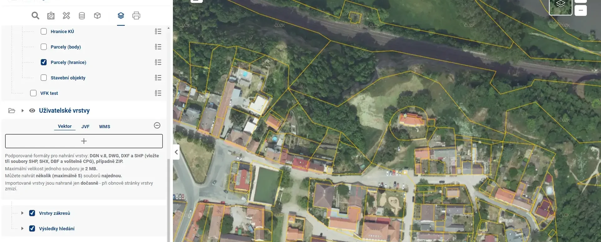
- You can upload a small drawing or file yourself directly via the layer organizer in the User Data section as a temporary layer. Click the “plus” button and select a file from your computer’s storage, or you can drag and drop the file(s) directly into the Geoportal onto the “+” button. The User Data feature in the Layer Organizer allows you to upload your own data in the following formats: SHP, DGN, DWG, DXF.
- The third option is to connect a remote data source via the WMS (Web Map Service) protocol as a temporary layer. You can add it to your project in the Layer Organizer under the User Data section. This allows you to view your data from another system as a WMS, as well as other publicly available thematic maps. These can include flood maps, protected areas, transportation accessibility, terrain maps, bike routes, and other maps from public sources.
When launching a new project in the Mawis Geoportal, we’ll help you prepare your data. We can work with a wide variety of data formats (there are approximately 200). We’ll check the data during import to ensure that everything is uploaded correctly to Mawis.
More similar articles
MawisGeoportal – Summer News for 2026
Printing up to A0, export to JPEG, 3D help, and faster record management. An overview of the summer 2026 updates to Geoportal.
MawisGeoportal integrates a full-featured 3D viewer
A new 3D viewer fully integrated into MawisGeoportal. No separate tools—the customer’s 2D and 3D data are all in one place and available online.
Search by Entering Geographic Coordinates
MawisGeoportal expands search capabilities using WGS 84 or S-JTSK geographic coordinates and links from other applications.


