


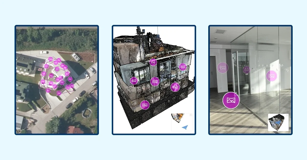
MawisGeoportal integrates a full-featured 3D viewer
A new 3D viewer fully integrated into MawisGeoportal. No separate tools—the customer’s 2D and 3D data are all in one place and available online.
I am delighted that this Friday, 11 September, our MAWIS portal – or rather, the MawisGeoportal application – will be expanded to include a host of new functions and features, particularly in the area of the 3D world.
We have, in fact, taken an important step forward in the development of MawisGeoportal by fully integrating a 3D viewer into it. No separate applications, no exports to other tools – all the customer’s spatial data (both 2D and 3D) is available in one place, online in a web browser.
What does this mean in practice? In 2D, the user has access to tables, attributes and all information about objects and, where applicable, other datasets. In 3D, the same object can be viewed as a model – and this model is also precisely located on the map, so you know exactly where it is in reality.
We currently support point cloud and spherical photo formats. And because we are building the 3D module as a living platform, we will gradually be adding further formats (such as Mesh) and functionalities (such as measurements). Furthermore, spherical photos are fully responsive and can be viewed on their own or in the context of the 3D model – and it is precisely this combination with the point cloud that further enriches the overall view of the object.
Before development, drawing on our many years experience with 3D data, we thoroughly analysed the available software and endeavoured to incorporate the best features into our own viewer. This is evident, for example, in the dynamic rendering of data and the ‘polished’ movement and navigation within 3D space. Behind this lies our own know-how on how to optimise large 3D data sets for the web so that they display smoothly directly in the browser.
Just as with 2D views, the 3D window can be easily exported and shared with colleagues – meaning that the view of the model is not limited to a single user but can be easily passed on. To help you find your way around the 3D scene, we provide an overview map that dynamically adapts to the scene currently on display.
The aim is for users to view their data intuitively, clearly and in context – without having to switch between different applications and without losing context between the 2D and 3D views. We believe that combining 2D and 3D data within a single Geoportal will take work with technical infrastructure, assets and asset records a step further.
➡️ Find out more about MawisGeoportal at mawis.eu/sluzby/geoportal.
Would you like to try out the 3D viewer?
Call me on my cell phone or send me an email. I’d be happy to show you 3D.
Ladislav Bláha +420 724 863 431 | ladislav.blaha@hrdlicka.cz
MawisGeoportal – Summer News for 2026
Printing up to A0, export to JPEG, 3D help, and faster record management. An overview of the summer 2026 updates to Geoportal.
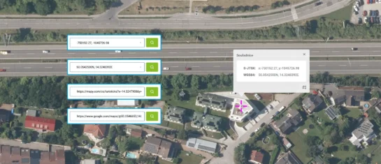
Search by Entering Geographic Coordinates
MawisGeoportal expands search capabilities using WGS 84 or S-JTSK geographic coordinates and links from other applications.
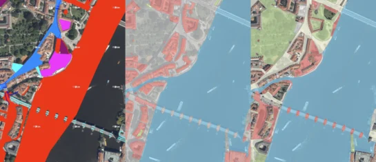
New KN Thematic Maps – Easements, Land Categories, and Land Use
Three new thematic map layers from the Cadastral Register (KN) are now available on the Geoportal: easements, land categories, and land use.


