MawisTools
Comparison of CN state over time
According to the Excel list of parcels (XSLX), which can be the result of the tools Search for affected parcels or Search for affected land blocks, the DGN generates drawings and an XLSX list with information on whether there have been changes in the areas and geometries of the parcels in the land register since the input list was taken. The land register data is updated daily.
The task allows you to
- Check with the list of parcels that they still exist in the land registry.
- Check the parcels to see that the area has changed.
- Obtain the current geometry of the parcels concerned (you can compare them with your original drawings).
Inputs – what they should look like
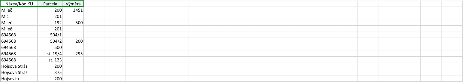
- XLSX input file – two possible formats
Simplified form: contains a list of parcels (in the first column: name or code of the parcel, in the second column: parcel number) or there may be a third column with the area of the parcel. The first XLSX row contains the above headings and is ignored by the tool.
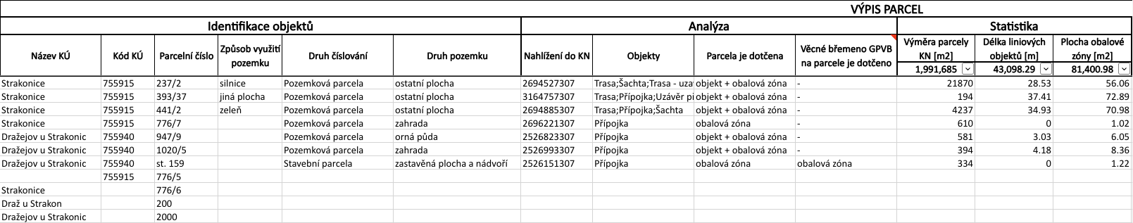
Result of the tasks: search for affected parcels and search for affected land blocks
Outputs – what I actually get
- List of parcels with information on the comparison of the CN status over time.
- DGN drawing with found parcels and possible VB geometries.
- Report of the analysis carried out including information on the status.
30 day demo
Fill out the form and we'll send you access to the MawisTools library for FREE for 30 days so you can try out the geomatics tools.