
MawisTools
3D cubature calculation
The tool is used to calculate cubatures between two surfaces defined in the input DGN file.
The task allows you to
- Check the cubic volumes of the charged shipment or removal on the basis of measured data from which you calculate the expected volumes.
- Make estimates of the volumes of materials to be moved during the foundation of the construction.
Inputs – what they should look like
- DGN file with input data for surface creation:
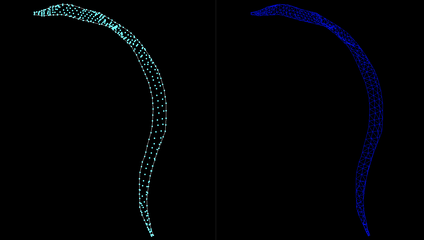
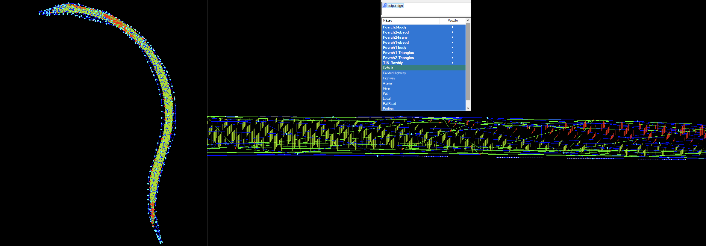
Surfaces can be specified by points, perimeter and optionally edges or directly by TIN and perimeter. Surface data must be in two separate layers.
If the surface is specified with points, a triangular area (TIN) is first generated and then the cubature is calculated to the accuracy you specify.
A specific example of the input data is included in the template accessible within the DEMO account.
The size of the Grid you enter has a significant effect on the complexity of the calculations. It must be chosen judiciously and allow for possible longer processing times.
Outputs – what I actually get
- DGN file with generated surfaces and a layer containing verticals showing height differences between TINs.
- Report of the analysis performed including status information.
30 day demo
Fill out the form and we'll send you access to the MawisTools library for FREE for 30 days so you can try out the geomatics tools.