
DTM CR - New tool for infrastructure management and planning
The DTM unifies previously fragmented data into a single digital model that can be used by both the public and private sectors.
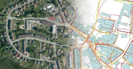
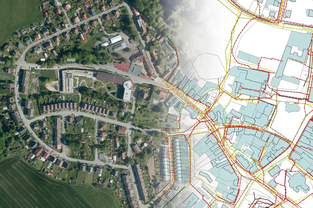
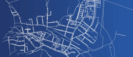
The Digital Technical Map of the Czech Republic (DTM CR) is a unified system for collecting, managing and sharing information on transport and technical infrastructure. It is created in cooperation between the state, regions, municipalities and network managers.
What is DTM CR and how does it affect construction processes
The main objective of the DTM CR is to create and continuously update a central database on utility networks, transport infrastructure, municipal territory and other construction objects. The data for the system is provided mainly by network administrators, builders and designers. The outputs are then used by authorities, municipalities and investors.
A fundamental change is the obligation of builders under Act No. 47/2020 Coll. to enter the location of their networks into the DTM. Failure to provide the data may have legal consequences, especially if the network is physically damaged in the field. In case of such damage, the builder is responsible.
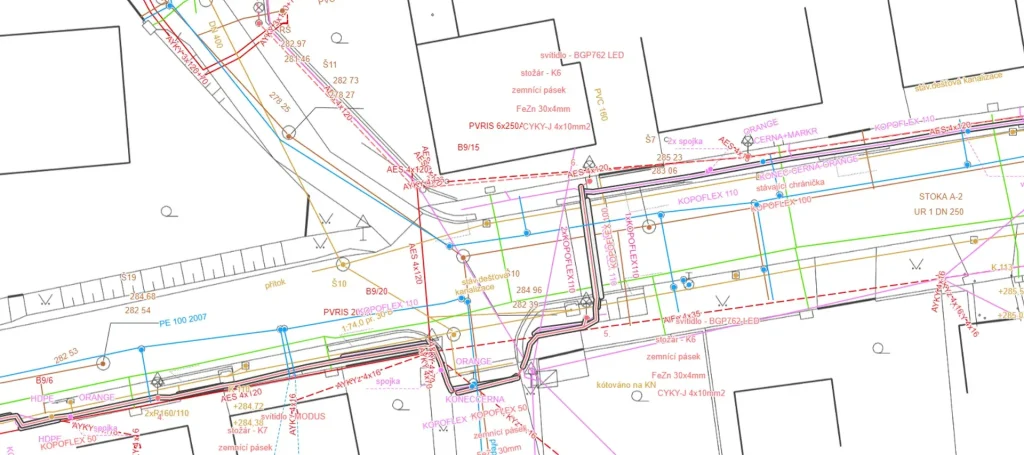
The data must be transmitted in the standardised JVF DTM exchange format. The DTM thus becomes part of the administrative procedure – especially for the permitting and approval of buildings.
The DTM has two basic layers:
- Basic spatial situation (ZPS) – basis for the location of buildings, includes the boundaries of plots, buildings, roads, etc.
- Transport and Technical Infrastructure (DTI) – includes network lines (water supply, sewerage, electricity, gas, etc.).
As an advantage, designers and construction companies gain access to up-to-date utility data before the actual design work begins. For authorities and utility managers, the DTM then provides a single source of information for assessing applications and managing assets.
(Source: Mawis – DTM CR and its importance for modern construction)
News from ČÚZK: DTM as a basis for approval
The Czech Office of Surveying and Cadastre (ČÚZK) coordinates the development of the DTM and continuously adjusts the methodologies to ensure that the system meets the requirements of the Building Act. Since 2024, a new obligation for builders is in force – during the final inspection of the building, the documentation must also include a geometric and positional survey of the actual construction in the JVF DTM format.
In connection with the development of the Digital Technical Map, legislation is being amended to change the requirements for the approval procedure. An amendment to the Building Act amending Section 232 has been published in the Collection of Laws under No. 87/2025, which will come into force on 1 August 2025.
Key changes:
- Until 31 July 2025, the builder may prove that the obligation to the DTM has been fulfilled alternatively – by submitting the geodetic part of the documentation of the actual construction (DSPS).
- From 1 August 2025 this procedure will no longer be accepted. The developer will be required to provide the record identifier by which the transportation and technical infrastructure documentation was uploaded to the County’s DTM.
This identifier is proof that the relevant data has been entered into the DTM system according to the CZSO methodology. Without it , the building authority will not grant approval.
The change applies mainly to linear buildings – water supply, sewerage, gas pipelines, electrical installations, roads – but in practice it also affects other types of buildings connected to technical infrastructure.
(Source: Mawis – DTM CR and important changes in building approvals)
MawisGeoportal: DTM Czech Republic in practice
To work with the DTM CR, you can use the online tool MawisGeoportal, which allows you to view the DTM data layers without the need to install GIS software. Users can access data on utility networks, parcels, buildings and other documents. The geoportal links multiple data sources into one mapping environment.
The application is used not only by planners, but also by representatives of towns and municipalities. For example, mayors use MawisGeoportal for checking planned interventions in networks, coordinating investment plans or communicating with citizens and developers.
Mawis services help users to produce outputs in JVF DTM format that are accepted by county authorities. This ensures a direct link between the project documentation, the statement of work and the authorities’ requirements. This reduces errors, speeds up the permitting process and helps to meet legal obligations.
(Source: Mawis – DTM CR and Geoportal application)
DTM Czech future
DTM CR represents a change in the approach to infrastructure data management. The obligation to submit data in a standardised format affects designers, construction companies and public administrations. DTM outputs become part of the permitting and approval processes and facilitate the work of all stakeholders. Tools such as MawisGeoportal allow the data to be viewed and worked with.
The obligation to share data with the DTM CR is therefore a fundamental step towards modern, efficient and safe management of technical and transport infrastructure, which brings benefits to all stakeholders and contributes to the overall quality of infrastructure in the Czech Republic.
More articles like this

DTM Czech Republic - important changes in building approvals
A significant legislative change that will affect the process of building approvals and obligations related to the Digital Technical Map of the Czech Republic.
Digital Technical Map of the Czech Republic and Geoportal application
How to effectively prepare utility data within the DTM CR project and how the Geoportal can facilitate their management.

Digital technical map and its importance for modern construction
The DTM CR simplifies construction processes, refines planning and improves the availability of infrastructure data.