MawisTools – Advanced analytical tools for working with geodata
Advanced analytical and processing tools for working with geodata and cadastral data.

MawisTools services include a range of advanced analytical and processing tools for geodata for surveyors, planners and geoinformaticians.

Advanced analytical and processing tools for working with geodata and cadastral data.
A tool for data conversion into the uniform exchange format of the Digital Technical Map of the Czech Republic (JVF DTM).
Advanced analytical and processing tools for working with geodata and cadastral data.
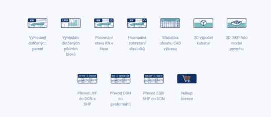
From the search of the parcels concerned to the calculation of cubatures or the conversion of data formats. Fast, online and without installation.

The converter allows you to create a drawing in DGN/SHP formats from JVF DTM data that you can view in your favorite application.
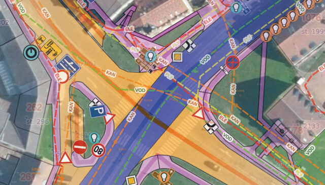
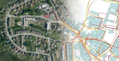
MawisTools tools automate and accelerate the processes of locating affected parcels, including ownership relationships.
Flight on the market
Users of
Applications submitted